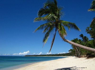
Nacatnagan Cliff Ilocos Norte
Nacatnagan Cliff Ilocos Norte adds a forested mountain backdrop to the coastal scenery of Pagudpud. Associated with Sitio Gaoa and the Maira-ira area, this elevated landform appears in local tourism descriptions for its outlook towards the surrounding coast. Pagudpud’s municipal website describes it as approximately 150 feet above sea level, or about 46 metres. Its combination of vegetation, elevation and coastal setting gives visitors another feature to discover while exploring northern Ilocos Norte.
The cliff also has a local name story that connects it with the landscape and the people who have described it over generations. Include Nacatnagan in your understanding of Pagudpud’s attractions, but check access before planning a climb. Published information about visiting is limited, and an older firsthand account reports that the land was privately owned. With arrangements confirmed locally, you can decide whether an authorised visit is possible or appreciate the surrounding scenery through other accessible coastal stops.
Where Is
Nacatnagan Cliff?
Pagudpud’s municipal tourism description places Nacatnagan Cliff in Sitio Gaoa. Travel descriptions also associate it with the landscape around Maira-ira Point and Blue Lagoon, where rising land forms part of the coastal setting.
When discussing a visit with your accommodation or a local guide, use the full attraction name and ask them to identify the location. Confirm where visitors may currently go and whether any proposed route crosses private land. A general reference on an online itinerary does not establish a public entrance or an open walking trail.
The Story Behind
the Name Nacatnagan Cliff
The name is one of Nacatnagan’s most memorable features. The municipal website explains the Ilocano word as meaning “fell down” and recounts a story about two carabaos, or Philippine water buffaloes, that climbed the mountain and fell over the cliff. According to this tradition, the incident gave the place its name.
Presenting this as local folklore preserves its interest without treating it as a documented historical event. For visitors, the story adds meaning to a geographical name that might otherwise be unfamiliar. Ask a knowledgeable local guide how the name is pronounced and whether they know another version of the account; local storytelling can be an enjoyable part of discovering Pagudpud.
Nacatnagan Cliff A
Forested Setting
Local descriptions identify trees, ferns and wild orchids among the vegetation associated with Nacatnagan. They also describe steep, slippery slopes, making the setting quite different from a constructed viewing platform or a level beach walk. The forested character is part of the attraction, but it also affects what a visitor should expect from any permitted route.
If access is available, take time to notice the vegetation as well as the view. Leaf shapes, bark textures and the play of light through foliage can provide rewarding subjects for photography. Leave plants where they grow and avoid stepping away from an established route to inspect or photograph them.
Nacatnagan Cliff
Nature Observation
Nacatnagan’s vegetation may interest visitors who enjoy listening and looking for wildlife, but detailed, recent site-specific records are limited in the sources available. Plan for general nature observation rather than travelling with expectations of seeing a particular bird or animal. Quiet observation can still make an outing enjoyable without a checklist of target species.
Bring binoculars if they are easy to carry, and pause where your guide considers it appropriate. For a dedicated birdwatching excursion, discuss a separate trip to a documented birding location. Kalbario-Patapat Natural Park including hornbills and birds of prey.
Planning a
Permitted Walk to Nacatnagan Cliff
If a visit can be arranged, ask for a clear description of the walk before committing. Find out about the distance, ascent, surface, exposure and expected return time. The published elevation alone cannot tell you how demanding the route will be, because the starting point and condition of the path matter just as much.
Choose the outing according to your group’s abilities. Visitors travelling with young children, anyone with limited mobility or people unfamiliar with uneven terrain should explain those requirements when making enquiries.
Nacatnagan Cliff
Weather and Preparation
Choose your day according to the forecast and the advice of the person arranging any authorised walk. Rain can affect footing, while cloud or haze may limit the outlook. An early departure is useful only when the access arrangements and conditions support it; a particular time of day cannot guarantee a clear view.
Wear secure footwear and bring drinking water, sun protection and a light rain layer. Carry belongings in a small backpack so your hands remain available while walking. Agree on a return time and transport arrangements before departure and allow your guide to adjust the outing if conditions change.
Other Coastal
Stops near Nacatnagan Cliff
Bantay Abot Cave and Timmangtang Rock also feature on the route towards Blue Lagoon. Their coastal forms provide additional photographic interest and can help create a varied excursion through this part of Pagudpud. Confirm the current access conditions at each stop, particularly where reaching a viewing position involves shoreline rocks.
Discuss a manageable selection with your driver rather than trying to visit every attraction in one morning. Leave enough time to walk comfortably, enjoy the views and take a break. A well-paced coastal trip allows each place to retain its individual interest instead of becoming a hurried sequence of photographs.
Nacatnagan Cliff Ilocos Norte
Nacatnagan Cliff brings together coastal scenery, forested slopes and a local legend explaining its name. Check current access and landowner permission before planning a walk, and combine your enquiries with sightseeing around Blue Lagoon and nearby coastal formations for a rewarding Pagudpud excursion. Nacatnagan Cliff Ilocos Norte or all you need to know.